 A list of all the people buried in the graveyard is available here: StMarys_Graveyard_Burial_List. It will download the Excel Spreadsheet onto your computer.
An almost complete map of the old section of the graveyard is available: StMarys_Graveyard_Older_Section
An almost complete map of the next oldest part of the graveyard is available: StMarys_Graveyard_Newer_Section.
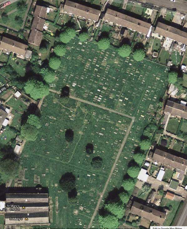
The newest section of the graveyard are graves first dug just after the second world war and furthest away from the church at the bottom of the path. The image below from Google Maps shows an aerial view of the church yard. Grave A1 is in the top right hand corner, Y25 is the bottom left hand side of that rectangular section. The graves are in a grid system reflecting that numbering, line A being the farthest right and line Y being the farthest left. On that line number 1 would be against the back wall and 25 nearest the path.
PLEASE NOTE: Care of the churchyard is the responsibility of the local authority and they carry out any maintenance required. If you have any concerns regarding the churchyard, please contact: Cheshire West & Chester Council. Telephone 0300 123 8123, E-mail: enquiries@cheshirewestandchester.gov.uk.